

Aircraft Equipment
Summary
Updated: 5/18/2024 Read time: 7 min
For a Part 91 Atlantic crossing to Europe, at a bare minimum, you need one long-range navigation unit (LRNU, aka GPS), short-range navigation equipment (VOR, DME, ADF), VHF radio with 8.33 spacing and immunity, a Mode S transponder and 1090 ES ADS-B out installed in the aircraft. An altimeter capable of toggling from inHg to hPa is not required but would be helpful.
With these, you can operate through the North Atlantic along the Blue Spruce Routes below FL290. Additional equipment such as HF, Datalink, and dual LRNUs, when paired with appropriate LOAs, unlocks more airspace.

Details
The above equipment is for operations beyond normal domestic ops. We are getting into the specific details of installed equipment requirements when flying in other counties and beyond radar and radio navigation range. You still need A TOMATO FLAMES for VFR, FLAPS for night VFR, and GRAB CARD IFR flying.
There are three distinct equipment categories to remember: Navigation, Communication, and Surveillance.
Navigation
Navigation equipment comes in three flavors: radio, area navigation (RNAV), and inertia-based systems.
Pop quiz: What are the two kinds of airspace?
A. Controlled and uncontrolled
B. Class I Navigation and Class II Nav
C. Towered and non-towered
Flying domestically, you are always within the radio navigation service volume of an NBD, VOR, and DME. This is the first kind of airspace: Class I Nav airspace. Within Class I, radio-based navigation systems are sufficient for operations. Outside the maximum service volumes of radio navigation (about 140 nm), you are in Class II airspace and must have long-range navigation capability (RNAV or inertia).

To utilize area navigation (RNAV), you need a Long Range Navigation Unit (LRNU). The most common is the satellite-based Global Navigation Satellite System (GNSS), the US-operated Global Positioning System (GPS) being the most ubiquitous. However, other satellite-based systems exist, such as Galileo (EU), GLONASS (Russia), and BeiDou (China). RNAV systems can also be TACTAN-based (VOR/TAC), DME/DME, LORAN-C, or utilize an Inertia Reference Unit (IRU).
Inertia-based systems are onboard position calculators. Think of it like you are your GPS satellite flying through the sky. These were cutting-edge before the proliferation of GPS and are still found on mid-sized jets and up today. The advantage is having a completely independent, self-contained LRNU. The disadvantage is their cost, and their performance degrades over time. Accuracy slowly drifts and must be corrected by calibrating the system before takeoff and enroute on long legs. For smaller aircraft, these systems are non-existent.
You will be flying beyond the radio-based systems from Canada to Greenland to Iceland, so at least one Long Range Navigation Unit is required. That LRNU could be an RNAV (GPS) or inertia system (ignore the other options above; you don’t have them). A second LRNU is necessary to acquire an RNP 4 or 10 LOA.
Did you catch that new acronym: RNP, Required Navigation Performance? You may come across RNP 1, 2, 4, 5, 10, P-RNAV, and B-RNAV, which all tie into the area navigation (RNAV) concept. In simplest terms:
RNP = RNAV + integrity monitoring + fault detection notifications for the pilot
Hang on to that concept; RNP is important when completing ICAO Flight plans for aircraft equipment and understanding LOAs, which we will explore later.
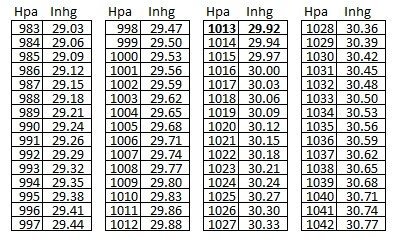
Lastly, your life will be simpler if your altimeter can be set in both inHg and hPa. Reporting pressure in hPa is standard from Iceland Eastbound. If not, don’t fret. A simple conversion chart can get you by on the fly.
Boiling it down, at a minimum, have an installed GPS (not a portable unit) and a VOR receiver to cover the navigation equipment requirements below FL290 (GPS covers DME & ADF).
Communication
Lots of threes in this article. The three main communication types are VHF, HF, and Datalink.
Very High-Frequency VHF is your standard comms ranging from 118 – 136 kHz. In Europe, there are two additional requirements. Your VHF comms need immunity, which they probably already do unless you are flying outdated equipment. Europe has required this since 2001.
Secondly, you need 8.33 kHz spacing. In the US, 25 kHz frequency spacing (119.000, 119.025, 119.050, etc.) works fine. However, the geography in Europe is much tighter, and additional frequencies are needed. Utilizing 8.33 spacing has four times the available frequencies to work with (119.000, 119.005, 119.010, 119.015, 119.025, etc.). So, from Iceland Eastbound, make sure you can dig into your radio's menu options and select the proper spacing.
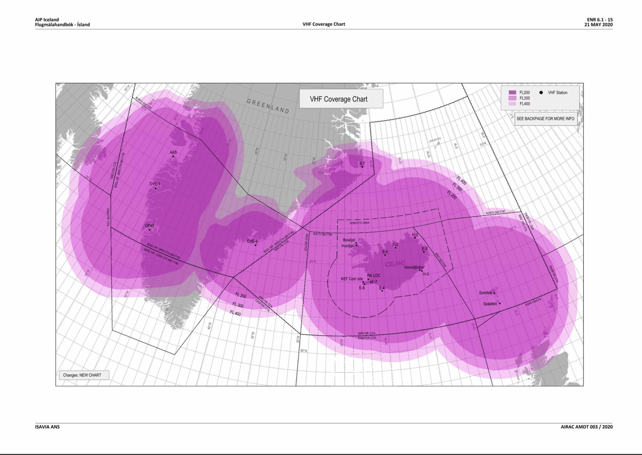
Icelandic Radio Coverage map at FL200-FL400
HF stands for High Frequency and is a longer wavelength than VHF. It is better for long distances but can have background static or be unavailable if there are blackouts caused by solar radiation.
Across the Atlantic, the blanket regulation is that you need to be in radio contact the whole time, and in Class II airspace outside of VHF radio range, an HF is required. There is, however, an exception. The Blue Spruce Routes allow you to cross without an HF if you fly high enough to receive VHF. Depending on the route, that minimum VHR reception altitude is either FL195 or FL250 between Canada and Greenland and about FL200 from Greenland to Iceland and Europe. Over the last decade, VHF comms have drastically improved. When flying at the appropriate altitudes, VHF comms were crystal clear for my last crossing.
You will need an HF radio beyond the Blue Spruce Routes, such as a trip to Bermuda. HF is an expensive option from OEMs. An alternate route is to install an additional antenna and use portable HF units. AVIATION HF has rental and purchase options.
Datalink can be radio-based or satellite-based. Satellite systems may qualify you for CPDLC (Controller Pilot Datalink Communications) over the Atlantic. Even though your aircraft may be qualified, you still need a CPDLC LOA authorization to unlock airspace above FL290.
If properly equipped and authorized, CPDLC drastically improves communication over the water. Position reports are automated and much clearer than the static of HF. Alas, CPDLC is currently out of reach of smaller GA aircraft.
Surveillance
“Radar contact” or “identified.” Comforting words to hear because even with the best navigation equipment and clear communication, someone is watching for you when you mess up and may be able to assist before it’s too late.
Yet another three: primary radar, secondary radar, and ADS.

Primary radar was first effectively used during WWII. The Brits scanned the sky for incoming air attacks and were able to intercept many raids. Primary radar displays a blip on the radar screen for airborne targets.
Secondary radar began picking up aircraft transponder data. At first, it was just a tailnumber (Mode A). It expanded to include altitude (Mode C), and now newer equipment can transmit more flight information (Mode S).
Your ADS-B (Broadcast) out equipment is related but independent. By analogy, your Mode C or S transponder is a text message to air traffic controllers. Your ADS-B is your X (Twitter) account. ADS-B takes the transponder data package and publicly broadcasts it.
Decades ago, the radar network expanded to cover almost everywhere overland. Besides some low-to-the-ground or mountain terrain areas, you can be confident you will be in radar coverage in the 48 states. Over the ocean, radar has typically fallen off around 100nm offshore, like radio and navigation reception.
Flying beyond radio coverage (Class II airspace) means you lost big brother. Monitoring your position and providing adequate aircraft separation relies on large ATC margins and reporting your position over comms unless you have ADS-C equipment. Don’t worry; if you have ADS-C, you will know about it.
But for your education, ADS-C sends the same data package as ADS-B. The C means “contract,” but it’s easier to think of it as “contact.” ATC pings your aircraft via satellite. Then, your aircraft sends the data back to them directly. Different levels of latency, or speed of transmission, determine performance. The right equipment paired with ADS-C LOAs is another requirement to get above that FL290 ceiling.
PC-12 Example
Navigation:
On a PC-12NG running the Honeywell APEX avionics package, there are two GPS units capable of area navigation. However, a single FMS controls both units, so the system only qualifies as a single LRNU. Adding the second FMS option ($$$$) would get you dual LRNUs and qualify the aircraft for RNP 4 LOA.
VOR, DME, ADF, and toggling between inHg and hPa come standard.
Communication:
From the factory, PC-12s have communication immunity and 8.33 spacing (+1 for European aircraft meeting European standards). The spacing is a toggle-able option within the Comms menu: Comms, Page/Detail button, select 25kHz vs 8.33kHz.
While not necessary, there are two HF options. Honeywell and Aviation HF.
Surveillance:
PC-12s with ADS-B out (from the factory or SB compliance) have Mode S Transponders and ADS-B out. The CPDLC option on some NGs is a VHF ground-based system and would not qualify for satellite-based CPDLC ops over the Atlantic.
Equipped as above, this PC-12 can only fly along the Blue Spruce Routes below FL290. Adding HF would let you fly a different route, such as through the Azores if you have an excellent tailwind; however, FL280 remains your top altitude.
Aviate
Verify you can select 25 kHz and 8.33 kHz in your avionics unit. While there, find the altimeter menu and check if you can toggle between inches of Mercury (inhg, i.e., 29.92) and hectopascals (hPa, i.e., 1013).
If you are interested in HF communication, check with your avionics support regarding an installation and/or with AVIATION HF.
